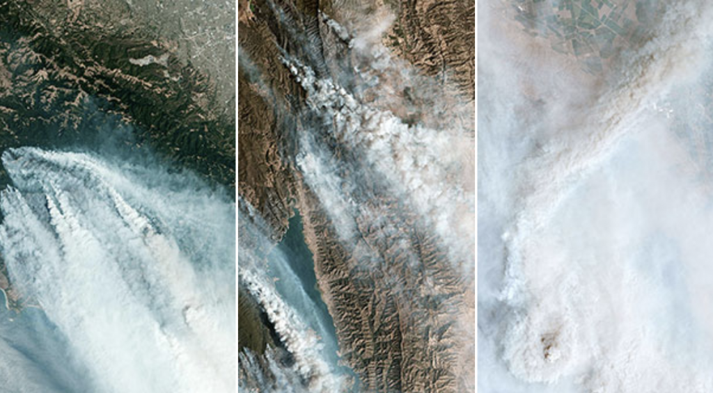
Since Aug. 15, hundreds of lightning-sparked fires across California have scorched an area about the size of Delaware. The National Oceanic and Atmospheric Administration’s GOES-West satellite captured this image loop on Aug. 19, showing wildfire smoke plumes billowing over the Western U.S., as a cyclone spins over the Gulf of Alaska to the north and Hurricane Genevieve, later downgraded to a tropical storm, whirls toward Baja California.
To view more satellite images and to read more please visit KQED.